Showing posts with label city walks. Show all posts

City Walk: Dolores Heights (#97)

7.25.2010 Comments: (1)

This city walk is in an area that's sort of in between a couple of different areas that we commonly visit. Before we did this walk, we'd never been to this specific neighborhood. I'm going to guess that it's because it's on the top of a big hill. But since I went ahead and wrote out this ambitious list of things I want to do in a span of time that is ever growing shorter, we got our butts up the hill.

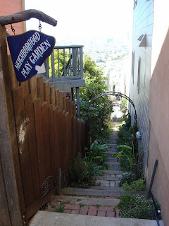
To be perfectly honest, this walk was pretty rough. It was a relatively warm day in SF, and the walk consisted of several stairways up, just to go downhill again. Not exactly a peaceful meandering stroll. The scenery was lovely, the architecture was great, and the views were breathtaking. My interesting information stops there though - this wasn't a walk full of rich history. Photos, though. Photos we have.


Sculptured redwood bench, because that's how San Francisco rolls. It was actually very comfortable.
So up near the top of the picture there, you can see that the house has what the book calls an "octagonal belvedere" and what I would call a "cupola." You should know that it is roofed in a pattern of blue and lavender tiles. That's right. These fools put a dome on the top of their house, and covered it with a mosaic. Friends, they need to find a new way to spend their money.

What you're seeing above looks like two streets but is actually the same street. In 1924, San Francisco "improved" the street by lowering the grade on just one side of the street (on the left there) and raising it on the other. What resulted is a street where some people's garages are now completely useless.
I want to live here. With a different car though.
Walk stats: 1.47 miles, 1.5 hours, same day that Spain won the World Cup!

City Walk: Presidio (#88)

4.11.2010 Comments: (2)
If you look up the Golden Gate Bridge on GoogleMaps, directly to the south, there's a big green area - that's the Presidio. It's 1490 acres - much of which is just open space. It used to be a US military post, as recently as 1994. Congress wrote a law stipulating that if it wasn't needed by the Army, it would be maintained by the Park Service and become part of the Golden Gate National Recreation Area. So, here we are. This walk only covers a tiny part of the Presidio, specifically in an area called Fort Scott, named after a general.

We walked by the parade grounds, and all the old barracks which are being updated to be leased out as housing. We walked by the pits where the artillery used to test dynamite, the Brig and the officers Rec Hall. We peeked through windows of other abandoned, decrepit buildings. We explored the old batteries where cannons used to protect the California coast line. It's a bit creepy - an entire civilization completely abandoned and just allowed to run down. Except that on the parade ground were people out for runs, walking their dogs and a little league baseball game. Strange juxtaposition.

It is one of the only places in the city I've visited where you get pictures from "behind" the bridge, and this is the only spot to get them so close. From here, you can see how the bridge actually has a bit of a rise in it that you don't notice from far away, or when you're on it.


This is the pit where they used to blow things up. We couldn't get inside of it, and Dan was sad.


This is one of the buildings that has recently been renovated, you can tell from the non moldy paint on the exterior. I couldn't get over the fact that they installed the chest high phallic looking artillery shells on either side of the entrance. For serious?


We completely missed this cemetery when we drove in, but had to stop and take pictures once we finally noticed it. Clearly, the similarities to Arlington Cemetery are obvious, but this is much more secluded.


Walk Stats:1.8 miles, 70 minutes


Coming next: My dad as a guest blogger!

City walk: McLaren Park and Excelsior (#99)

3.07.2010 Comments: (0)
Ugh, that last post about the brewery tour would have been so much better had I written it when I actually remembered something - apologies. Hardly my best work.

While Dan and I have a car this month, we've been trying to get to different places in the city that would take a wee bit longer on public transit. So, we decided to do the city walks that were furthest from our apartments. This walk mostly takes place in the second largest park in the city, McLaren Park, which we had never heard of, so it was nice to explore a completely new area. The park was named for John McLaren, who was the chief gardener at Golden Gate Park for 60 years. I think that is a lovely gesture.

The walk took us through a bunch of groves, play areas, a couple different lakes, and other nature type things. At one of the lakes, Dan took approximately 47 pictures of ducks, which I have not included here, I know you're disappointed.

Other things we encountered:


Statues meant for children that also sort of look like they were made by children.


This woman with her 7 or 8 black lab puppies who were all not on leashes but all ridiculously well behaved who sort of adopted the bull terrier (the one that doesn't look like the others) and then the terrier would. not. go. back. to his owner. It was sort of heartbreaking to watch him have to leave his newly found gang.


The Jerry Garcia amphitheater. Underwhelming, don't you think?


This dog hanging out of his house window, just chillin, watching people go by.


Steep, steep stairs. Can't really tell from this picture, but remembering makes my calves hurt.


Walk stats - 2.3 miles, 1.5 hours

City Walk: Potrero Hill

11.22.2009 Comments: (1)
Another day, another city walk post. This area of San Francisco is called Potrero Hill, which is south of the downtown area of SF, and is a bit more industrial than other walks we've been on. It is also a really tight knit residential community, and supposedly where the "up and coming" folks in SF want to live. It is pretty obvious that if you want to live on the top of the hill, your income better be up as well.
A fun fact about the neighborhood is that is was entirely unscathed after the 1906 earthquake and fire, so big numbers of people who lived in the city at the time migrated here. Tent cities popped up, and many people never left. So, this neighborhood's history is really ethnically diverse, where other areas tend to be more homogeneous in background.
This building used to be a recycling center, but is now an office building, and also holds a culinary institute. When the offices were built, this feature on the ground level was added to "give historic perspective"
Me on a colorful bench created by the residents of course, in the mini park at the very top of the hill (300+ feet).
A shot of Vermont Street, which is actually the windiest street in the country. It's just much harder to get to and not nearly as pretty as Lombard.
One of the bonuses of living in the Bay Area - this community garden is on a residential street, which takes up at a lot that could hold a single family home. Where else would a garden hold more precedence than another house?
Views, views, views!
Our starting and ending point. A compass rose made of....beans?

City Walk: Eureka Valley

9.18.2009 Comments: (2)
We really have been in the Bay Area for selected parts of the summer, I promise. During part of that, Deborah was staying with us (before she abandoned us to move to Australia I mean) and one of the things she really wanted to do was go on a city walk with us. So to the city we went. Deborah chose our walk - Eureka Valley. The area sits on a hill, beneath Twin Peaks and right above the Castro. The walk was pretty long with some of the longest hills we've encountered yet, and easily the windiest day we've done a walk. This turned out to be unfortunate, because Deborah is in way better shape than Dan or I. There's no real history or fun facts I can give you about this area, because our book mostly talks about the Castro, and also Harvey Milk. I won't go on about Milk here except to say that if you have no idea who I'm talking about, I need you to go rent the movie "Milk" that came out last year. SO GOOD.
This is an alley between two homes, and is super cute, leading to a little neighborhood park. It's actually called Acme Alley, and used to be a path used for taking cattle across the city to pasture.
These are the Seward park slides, which were waiting for us at the end of that stairway. They are AWESOME slides. All the neighborhood kids have left stacks of cardboard for anyone to use, and the slides are super fast. We regressed a few years to play here for awhile.
Clearly, playing here is for serious.
Some of the hills here are so steep that stairs are built into the sidewalks. Not as a separate set, but carved right there into the concrete so that you don't have to lean into the hill like a crazy person while you head uphill. This is one example. Probably one of the longest hills we've done. My calves are burning thinking about it.
This is ONE house. It was built for $100,00 in 1872 and has 5 stories, 45 rooms, 52 closets, 10 fireplaces and 272 windows. It's now 15 one bedroom apartments.
You can't really tell, but the city is pretty much laid out behind us. Good walk team!
(Walk stats: 2.02 miles per Google Earth, 2 hours)
Up next: Saratoga Springs, NY. Weddings and horse races.

City Walk: Pacific Heights

6.28.2009 Comments: (3)
Continuing on the quest to appease Rosa, and to get through all the urban hikes in our book o' city walks, we completed another one last Thursday. I know you may be kind of tired of hearing about them. If so, sorry...because we've done 10 of them, and there are 26 total. Get excited. If I had been reading ahead like I usually do, I would have noticed that this one basically connected to the walk we last posted about here, and we could have completed them in one day, although that would have been a lonnnnnnnnng walk. So, instead, we had to go all the way back to pretty much the same area as the last walk. This walk was in Pacific Heights, which started being developed into a residential area after the first cable cars started running up and over the hills in the 1870s. Parts of it are pretty flat, so the lots were able to be drawn large, and rich people bought them right up and WOW. The homes are enormous. I feel like I have said that about a few of the walks already, but these are a new level of outlandishly huge. They're more like homes you would see on a plantation, with hundreds of acres of land around them. Except they're in a city, right next to each other, on the same streets. View of the Bay from our starting point This is where the Consulate General of Norway hangs out. We passed by a few residences of Consulate Generals...including Norway, Indonesia, Italy, and Ireland. Alta Plaza Park, built on a really steep bit of land. Problem solved with LOTS of stairs. Great view at the top though. Also at the top - a picnic table full of adults letting their children run amok in the playground, and their dogs chase each other, while they chilled with several bottles of wine. The port-o-potty down on street level that Dan had to run down and use, since the bathrooms in the park had already been locked for the day. I'm pretty sure he was actually in there when I took this picture. (TMI?) House. Not sure what else to say about this. Except, WHY do people have this much money?!? House again. Hahaha not really. It's actually a private school for K-8th grades. Still, pretty ridiculous. (D: It still used to be someone's house!) Aston Martin. Parked on the street, in front of a house with a garage. What on earth is in the garage? And now, for movie fun facts of the day: House front that was used as the school front in The Princess Diaries House from Mrs. Doubtfire (Stats, for Rosa. Per Google Earth, walk was 2.55 miles and took us 1 hr. 45 mins.)

City Walk: Presidio Wall

6.17.2009 Comments: (2)
Since now there are enough daytime hours on the weekends for Dan and I to sleep in, make breakfast, BART into the city and do a walk without rushing, we've decided to take up the urban hiking again. This walk started at 379 feet above sea level and took us around some enormous homes, the Palace of Fine Arts, the Marina area, and skirted alongside the edge of the Presidio. We also wandered through the Letterman Digital Arts Center, which is the home of Lucas Arts. Yes, that George Lucas. Stairs looking down - the Lyon stairway. And looking back up. The hearts are all over SF, each painted by different artists. Kind of like the donkeys/elephants and pandas in DC. These aren't an exhibit anymore, the ones we run into have been purchased and permanently placed where we find them. Welcome to working where George Lucas has enough money to get you an office with a sweet view (Golden Gate Bridge in the background) and great landscaping. So the Letterman Digital Arts Center was named for the Letterman Army Hospital that used to live on the site where Lucas Arts is now housed. It took 5 years to build, has a gold LEED certification, houses 1300 employees and a Starbucks. And this beautiful fountain. Why yes, that is Yoda on top there. Close-up. I maintain that he looks amazingly realistic - like he could talk to you any second. All the ponds and creeks that you saw in the above picture are manmade. Evidence below. Out on a jetty into the Marina is the Wave Organ. It is a scuplture (of marble and granite, recycled of course) with pipes extending down into the bay. The tubes that are above the surface project the acoustics of the water movements, hitting the pipes below. It's pretty awesome. View of SF from the Wave organ Later on in the walk in Pacific Heights - Imposing entrance to a home Someone's fish tank - outside their house. The faucet that fills the tank, also waters the plants above the tank, which grow on the wall. It was a pretty sweet setup. We tried 6 times to take a picture of ourselves with the bridge behind us, and finally jsut gave up and went with the "pseudo-artsy-but-really-just-can't-take-a-good-picture" style.

Hoping to do another this weekend. Stay tuned.

Urban (snooty) Hiking

1.21.2009 Comments: (1)
Dan and I went on walk #3, which was up in the ridiculously wealthy area of SF, Nob Hill. The name would also imply that it is a steep, you know, hilly area. I want you to know that we chose to do this walk after going to a nice lunch (it's Dine About Town again! woot) and walking like, almost a mile, to the START point of the walk. Good decisions all around. So, the area is where the "Big 4" railroad barons of the early 1900s made their ginormous homes. One of them took up an entire city block. One of them had a gated wall and "tradesmen" entrance. Way too much money. So yeah, they built some mansions, and their friends built some mansions and after the big 1906 earthquake, only ONE of their homes survived. Because the quake started a huge fire, andddd all of them but ONE built their homes out of wood. Fantastic. Grace Cathedral - the whole complex takes up an entire square city block The bronze doors to Grace Cathedral Inside the Cathedral - shocking news, it was based on Notre Dame A view from the labyrinth inside the cathedral Looking down a cute little alley A really ornate apartment complex entryway The apartment building where "Vertigo" was filmed Dome inside one of the fancy hotels